http://www.google.com/imgres?imgurl=http://indiemaps.com/images/isolineFinished.png&imgrefurl=http://indiemaps.com/blog/2008/06/isolining-package-for-actionscript-3/&h=214&w=504&sz=47&tbnid=AQn_NgxbiYB65M:&tbnh=47&tbnw=110&zoom=1&docid=RhaGUUX3USnVmM&hl=en&sa=X&ei=7wITT7ToBcTDgQeJlOTUAw&ved=0CDkQ9QEwBA&dur=4143
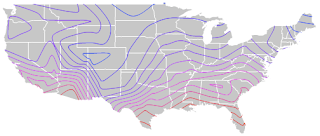
This is an isoline map. It takes an image of a region and puts lines on it joining regions with something in common.This map shows an image of the United States and the temperature of certain parts and how it relates across the country.

No comments:
Post a Comment